Geospatial Energy Map of India
2021 OCT 20
Preliminary >
Economic Development > Miscellaneous > Energy sources' distribution in india
Why in news?
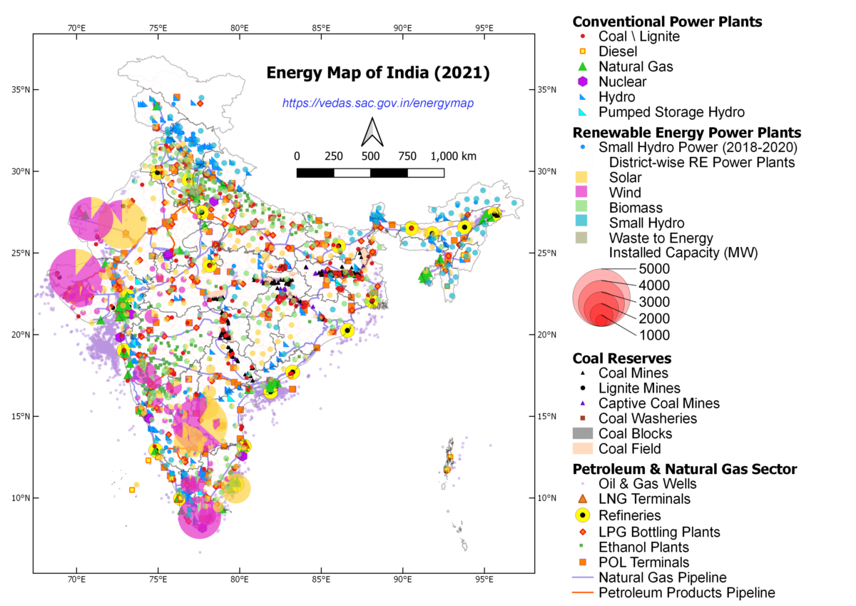
- NITI Aayog in collaboration with Indian Space Research Organisation (ISRO) has developed a comprehensive Geographic Information System (GIS) Energy Map of India.
About the map:
- The map provides a holistic picture of all energy resources of the country which enables visualisation of energy installations such as conventional power plants, oil and gas wells, petroleum refineries, coal fields and coal blocks, district-wise data on renewable energy power plants and renewable energy resource potential through 27 thematic layers.
Features:
- The map attempts to identify and locate all primary and secondary sources of energy and their transportation/transmission networks to provide a comprehensive view of energy production and distribution in a country.
- It is a unique effort aimed at integrating energy data scattered across multiple organizations and presenting it in a consolidated, visually appealing graphical manner.
- It leverages the latest advancements in web-GIS technology and open-source software to make it interactive and user friendly.
- The map will be useful in planning and making investment decisions.
- It will also aid in disaster management using available energy assets.
PRACTICE QUESTION:
Geospatial Energy Map of India, recently seen in news, is launched by
(a) Department of Science and Technology
(b) NITI Aayog
(c) Ministry of Earth Sciences
(d) Bureau of Energy Efficiency
Answer