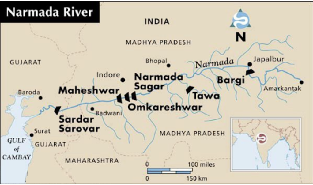
Narmada River
2023 SEP 20
Preliminary >
Geography > Resource geography > Resource geography

Why in news?
- Severe rains in Gujarat caused the Narmada River to flood, displacing thousands. Some blame the Sardar Sarovar Dam operators for their delayed actions.
About Narmada River:
- Narmada is the largest west flowing river of the peninsular region flowing through a rift valley between the Vindhya Range on the north and the Satpura Range on the south.
- It rises from Maikala range near Amarkantak in Madhya Pradesh.
- It drains a large area in Madhya Pradesh besides some areas in the states of Maharashtra and Gujarat.
- The river near Jabalpur (Madhya Pradesh) forms the DhuanDhar Falls.
- There are several islands in the estuary of the Narmada of which Aliabet is the largest.
- Major Tributaries:
- Hiran, Orsang, the Barna and the Kolar.
- The major Hydro Power Projects in the basin are Indira Sagar, Sardar Sarovar etc.
Narmada Bachao Andolan (NBA):
- It is an Indian social movement spearheaded by native tribes (adivasis), farmers, environmentalists and human rights activists against a number of large dam projects across the Narmada River.
- Sardar Sarovar Dam in Gujarat is one of the biggest dams on the river and was one of the first focal points of the movement.
PRACTICE QUESTION:
Which of the following statements is/are correct regarding?
1. Par river flows through two Indian state
2. Tapi river originates from Satpura Range
3. Narmada river flows in a rift valley
Select the correct answer using the code given below:
(a) 1 and 2 only
(b) 2 only
(c) 1 and 3 only
(d) 1,2 and 3
Answer
