Leh-Manali Highway
2020 SEP 25
Preliminary >
Geography > Economic geography > infrastructure
Why in news?
- Leh-Manali is a crucial link to the border regions of Ladakh union territory.
About the highway:
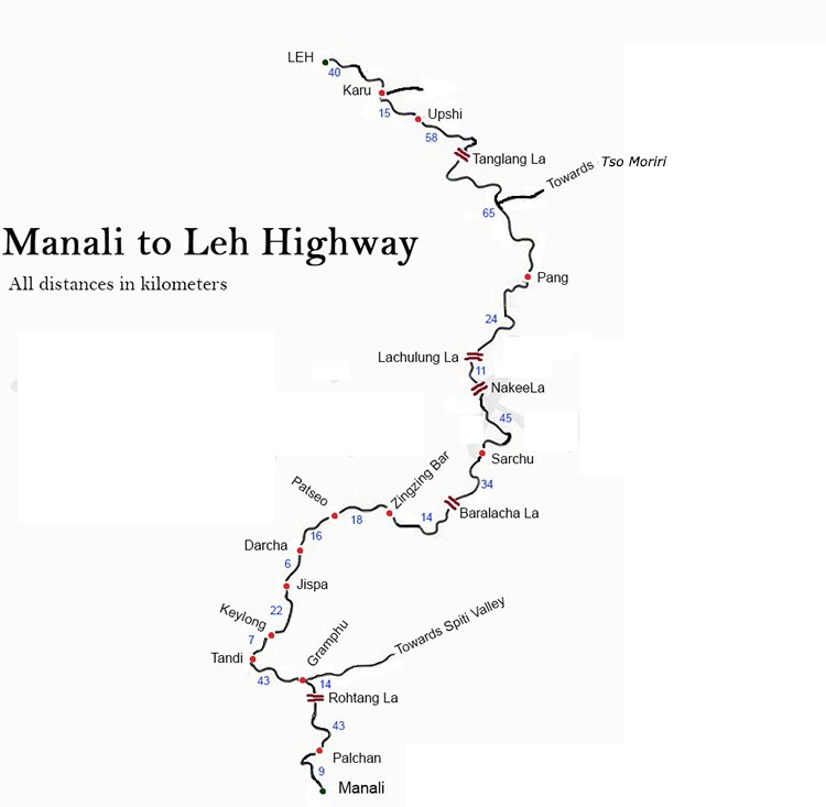
- The Leh–Manali Highway is a 475 km long highway that connects the Manali valley to the Lahaul and Spiti valleys in Himachal Pradesh and the Zanskar valley in Ladakh.
- It is open for only about four and a half months in a year, from May or June, when the snow is cleared, and mid-October, when snowfall again blocks the high passes.
- The Leh–Manali Highway was designed and built and is maintained by the Border Roads Organisation (BRO) of the Indian army. It supports the heaviest army vehicles.
Geographical features:
- The average elevation of Leh-Manali highway is more than 4,000 m (13,000 feet).
- The highway is flanked by mountain ranges on both sides and crosses many small streams of ice-cold water from snow-capped mountains and glacial melts.
- The route crosses many mountain passes including:
- Rohtang
- Baralacha La
- Nakee La
- Lachulung La
- Tanglang La
- Of these, Rohtang tunnel will soon be bypassed by the ATAL tunnel which will provide all weather connectivity between Manali and Spiti Valleys.
PRELIMS QUESTION
Consider the following statements regarding Leh-Manali Highway:
1.It passes through Rohtang Pass and Bara Lacha Pass.
2.It is now open through out the year for Traffic.
Which of the statements given above is/are correct?
(a)1 only
(b)2 only
(c)Both 1 and 2
(d)Neither 1 nor 2
Answer to prelims question